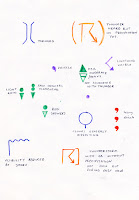
First project for third year for me is all about Tornados... I've chosen this subject in particular as it's dealing with scientific information, something that I haven't attempted to illustrate before, and is very different to my intentions for my personal project... I'd like to see if I can put a more narrative spin on how I show the information rather than just pure information drawing, in my opinion it'd be more fun and engaging to learn about the subject from a format like that? I am also interested in exploring moving image as I think it'd be the most directly relevant way to show Tornado information, basically all weather forecasting/weather warnings are either on TV or online and a lot of the diagrams that I've found are animated.
So far my initial research has mostly been from websites, and from books, I'm finding it quite difficult to find anywhere that I can actually go and visit (in the UK) which will have information about Tornados - surprisingly both the Natural History Museum and The Science Museum had basically no exhibits about meteorology/the weather, and subsequently nothing about tornados which was quite disappointing, the BBC is very secretive about where their weather station is, and it seems like the Met Office rarely allow visits. I did see this cool video installation in the ecology section of the Natural History Museum, basically the only thing I did find that had some lateral relation to my project. ~
(title quote from here, obviously it's nothing in comparison to America, but it's something that I didn't know)


No comments:
Post a Comment